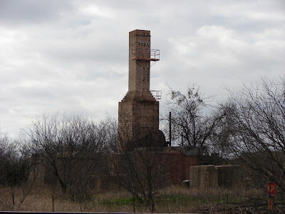
On Saturday the 15th I finished my westward scout to Fort Griffin & Albany by detouring south down through the Necessity community and onto the brick streets of Strawn. FM-207 is a fine, scenic drivers road that starts just east of Breckenridge, and on that gray day there was no traffic so I flew down at speed. From the ridge tops I could look across into the valleys still filled with light fog.
The road intersects SH-16 just above the bridge across Palo Pinto Creek. Just across the bridge on west side is the old Dr. Pepper bottling plant and tourist center, the first of several remnants of the time when Strawn was a fixture on the old Bankhead Highway.
This is a remarkable complex of red brick structures that lie on the bridge approach and down lower on the flood plain of the creek. There is a fine residence with its outbuilding all still in use, another intact building of good size and the shell of the old tourist courts laying further back. Everything is well maintained although the buildings appear to be unused. I noticed new paint and some planters in front of the main building as I went by. I got more details at a later stop.
This is a remarkable complex of red brick structures that lie on the bridge approach and down lower on the flood plain of the creek. There is a fine residence with its outbuilding all still in use, another intact building of good size and the shell of the old tourist courts laying further back. Everything is well maintained although the buildings appear to be unused. I noticed new paint and some planters in front of the main building as I went by. I got more details at a later stop.
Note: All these pictures were taken on trips in previous years when the light was better.
Just across the highway is the unused old water tower with a dilapidated brick pump house, and to the east of that on the little bluff above the creek a huge old brick funeral home that once was a private residence. There is some history there to be found.
Front Street runs on both sides of the T&P railroad and North Front has most of the historic buildings that were the downtown. The old Bankhead Hotel and Apartment building is still very visible and has recently been spruced up with new paint and repairs since the picture was taken. To the east on Front are additional buildings , many still in use as are those on the north-south Franklin Street. Off the main drag is the impressive Strawn City Hall building.
If you drive around Strawn a little you notice many Thurber brick streets and a number of very comfortable homes of all sizes, most of which are of brick construction. People lived well here in the golden years of coal mining and oil production. As the city grew, they built Tucker Lake several miles to the west on a branch of the North Palo Pinto. It lies above a small park and a rough road will take you up to some fine views. The farm road follows the rails until the T&P curves a little north to get through the gap to Ranger at Wilde Canyon which is private and inaccessible.
The Strawn Historical Museum: As I swung around by Mary's Cafe for a last look, I noticed that the normally closed Strawn Museum across the tracks had a car parked in front. So, I drove over and walked in. The building which is set back from North Front looks very small, but inside is fairly roomy. I shook hand with Bob Stogsdill the museum host and started my look around. Bob is a good guy and very knowledgeable about Strawn and the area and showed me some interesting exhibits, pictures and maps. The Museum, in spite of depending mostly on donations is working hard to improve and it shows. They are open from 11 AM to 4 PM on Friday, Saturday & Sunday and now have a page on Facebook as well as an occasional Newsletter. If you are interested in the history of south Palo Pinto County, it's well worth the time to stop in.
All pictures and illustrations ©2011 Electric Books Collection ~ Pete Charlton
 |
| 1935 Strawn Coal Field Map ~ UT |
 |
| 1928 Plat of the Town of Strawn |


No comments:
Post a Comment